The little harbor town of Grand Marais, Minnesota is surrounded by some of the best family hiking in the Midwest. And almost all these trails are an easy day trip from your stay at Okontoe—or they make fun stops on your way up or back home.
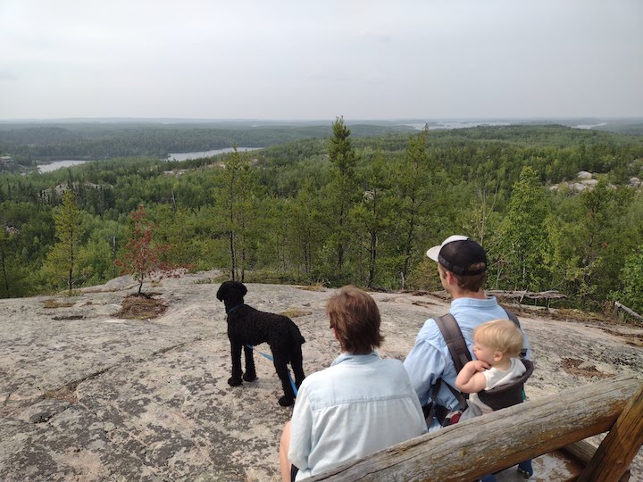
Here are 23 of the best hiking trails for the whole family, starting with preschoolers—most within an hour of Grand Marais.
Some involve dangerous drop-offs and steep climbs, so keeping young ones well in hand is required. But you’ll be rewarded with breathtaking views, abundant waterfalls, rocky scrambles and plenty of chances for active youngsters to run off energy.
Getting to all 23 of these is a great excuse to come back to our beautiful area again and again. And our rustic Retreat Cabins and spacious, wooded campsites make an ideal basecamp for all these hiking adventures.
(NOTE: Cell service can be spotty along Highway 61 and is either spotty or non-existent along the Gunflint Trail. It’s a great idea to have paper maps for these trails/trailheads or have your phone map pulled up while you have cell service or wi-fi.)
Parking is free at the trailheads unless stated otherwise.
Family Hikes Southwest of Grand Marais along Hwy 61
We’ll start with the final hour or so before reaching Grand Marais from Duluth and the Twin Cities.
All of these can either be accessed directly from Highway 61 or are just a short drive up a forest road. Many of these take full advantage of the beautiful views along the North Shore of Lake Superior. Others are great for viewing the several waterfalls along the shore.
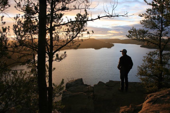
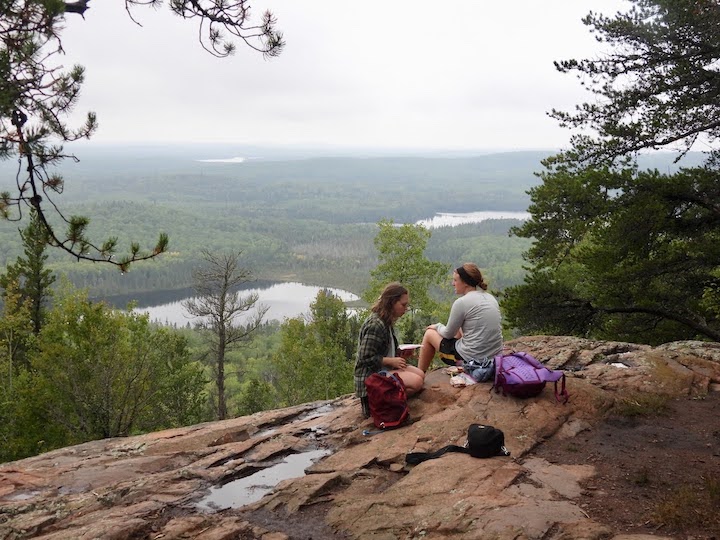
1. Tettagouche State Park: Shovel Point Trail
(55 minutes from Grand Marais • 89 minutes from Okontoe)
If you only hike once along Lake Superior’s North Shore, this is the one you want. It’s short (1.4 miles total), relatively easy and absolutely stunning.
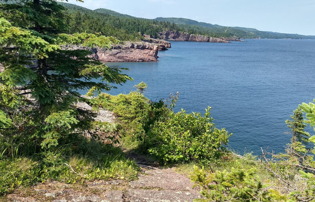
You’ll pull off into the Tettagouche State Park Visitor Center parking area. If it’s high season (summer) and especially weekends and midday, you may have a challenge finding a parking spot! This area is SUPER popular.
Take the trail behind the Visitor Center and head left. The trail starts paved, turns into dirt quickly and includes several dozen steps to take you to the top of the high cliffs.
While you may be hiking with lots of other folks up to that point, don’t stop there as most do. Continue down the trail to the end of the point where the ground slopes down closer to the water.
You can spend lots of time exploring the north side of the point then, with plenty of rock scrambling for the kids. The views of Lake Superior are some of the best you’ll see—and from many different spots along the hike.
A spur trail close to the base of the stair system will take you right down to the water. It’s worth the extra time to see things from that vantage point, too.
For this trail and next, there are modern bathrooms inside the Visitor Center as well as a fun little gift shop.
2. Tettagouche State Park: High Falls Trail
(55 minutes from Grand Marais • 89 min from Okontoe)
From the same parking area at Tettagouche, you’ll find the trailhead to High Falls. Walk down towards the river and look for the trail that heads under the highway bridge and away from the lake.
This trail is longer, about 3 miles round trip, but not difficult. This High Falls is a 60-foot waterfall on the Baptism River. It’s Minnesota’s highest waterfall that lies completely within the state’s boundaries. (We’ll tell you about another High Falls in a few minutes.)
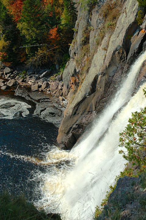
There’s a manmade platform and walking bridge at the brink of the falls that offers great views of the falls, the pool below and the river valley as it heads toward Lake Superior.
Along the way is a short spur trail downriver from High Falls to another set of smaller falls that are also very beautiful. This trail takes you down to river level via a set of steps.
Book Your Stay at Okontoe Today
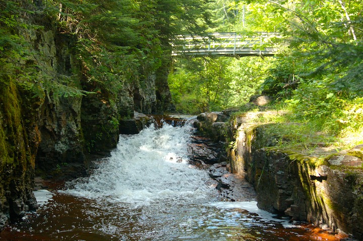
3. Caribou Falls Trail
(44 min from Grand Marais • 75 min from Okontoe)
Just inside the Cook County line is Caribou Falls State Wayside where you’ll park for this trail. It’s right off the highway, turning away from the Lake. It’s about a half-mile hike to the falls—a mile roundtrip.
You’ll need to take the steep stairs down for the best place to see the falls. But they’re not long and it’s definitely worth it.
You may be able to catch glimpses of Lake Superior through the trees as you hike back to your vehicle.
There’s a vault toilet at the Wayside parking area if you need it.
4. Temperance River State Park: Hidden Falls Trail
(33 minutes from Grand Marais • 66 min from Okontoe)
While Temperance is an easy stop along your drive up to Okontoe, this area is close enough to save for a day trip during your stay.
You can’t miss the parking lots for this trailhead as Highway 61 drives right through them.
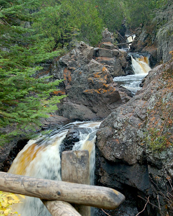
The biggest attractions along this trail are the series of cascading falls through the Temperance River Gorge as the river makes its way to Lake Superior.
The rocks are wonderful for scrambling over and there are multiple views of the potholes and waterfalls. The top of the gorge is maybe a quarter mile from the trailhead, so it’s not long. But the whole family can find plenty to do and see for an hour or two here if you want to take the time.
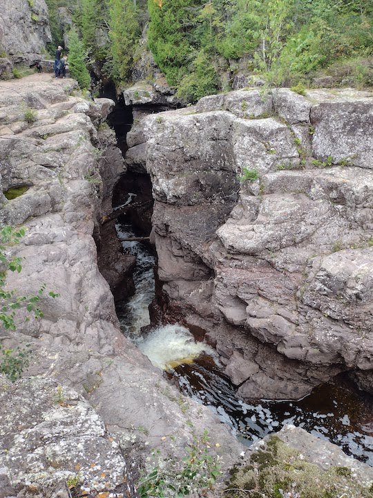
(Be sure to keep your little ones close to you as there are dangerous drop-offs above the fast-moving river.)
Once you return from seeing the falls, cross Hwy 61 and take one of the trails on either side of the river for the short jaunt towards Lake Superior for more great views.
There are no facilities at the trailhead.
5 & 6. Carlton Peak/Britton Peak Trailheads
(34 minutes from Grand Marais • 67 min from Okontoe)
For the trailhead parking area to Carlton and Britton Peaks, you’ll need to turn off Highway 61 onto the Sawbill Trail in Tofte. It’s just a 5-minute drive up to the parking lot, which will be on your right.
Britton Peak is about a mile up and back and very steep! If your family feels adventurous, go for it.
Carlton Peak is Minnesota’s second-highest point (the highest is Eagle Mountain, further down on this list). Follow the signs for the trail across the Sawbill and into the woods to the peak. It’s about 3.5 miles out and back and so worth it.
The hardest part is the spur trail to the peak itself, but it’s not too bad. The rounded summit has amazing views of the inland forests and Lake Superior.
On your way back, it’s just a short hike up the Tofte Peak spur trail for more gorgeous views if you’re up for it.
There’s a vault toilet at the trailhead if needed.
7. Oberg Mountain Trailhead
(31 minutes from Grand Marais • 64 minutes from Okontoe)
Oberg Mountain is arguably Minnesota’s most popular fall color hike because of the many maple trees that flourish in that area. But it’s beautiful any time of year and is easily doable with even young children.
This is another one where you’ll want them to stick close to you at the overlooks as some are on high cliffs with dangerous drop-offs.
The trail has a couple of short steep-ish sections, but most of it is easy or moderate. You’ll be rewarded with spectacular views of Lake Superior, the inland hills and forest, and Oberg Lake.
The parking lot and trailhead for Oberg require a 5-minute drive up the Onion River Road off Highway 61. There are vault toilets there if needed.
Once you’ve parked, make your way back to the road and across to the trailhead. It’s a loop trail, about 2.25 miles altogether.
Oberg is truly one of the North Shore’s gems.
8. Cascade River State Park: Cascade River Loop
(13 minutes from Grand Marais • 46 minutes from Okontoe)
Here’s another gorgeous and short river loop with great views of several small cascading waterfalls. While, as in other trails listed here, you can go much further than just the half mile loop, this is the shortest and prettiest part.
The parking lot and trailhead are right along Highway 61, just a stone’s throw northeast of Cascade Lodge.
This is an easy hike for all ages. Again, keep your youngest ones close to you as the river runs quickly and there are plenty of places to slip. It’s super pretty, with an almost secluded feel the way the trees overhang the river.
The trail takes hikers up one side of the river, across a footbridge and back down the other side.
There are no facilities at the trailhead.
9. Cascade River State Park: Lookout Mountain Trail
(13 minutes from Grand Marais • 46 minutes from Okontoe)
While you’re at Cascade, another more challenging option for families with older kids is the hike up Lookout Mountain.
You’ll park in the same spot and start at the same trailhead. Be sure to start on the west side of the river and look for the sign for the Lookout Mountain spur trail.
It’s a good idea to have a map for this trail (like this one from the Superior Hiking Trail Association or pick up a trail map in the State Park Visitor Center there if you have a vehicle permit) as there are several spur trails in the area.
The summit of Lookout Mountain is 600 feet above Lake Superior, so be ready for a workout! It’s about 2.25 miles, so not too long though. Your hard work will be rewarded with great views of the hills, forests and big lake.
Hiking in Grand Marais
Next, we’ll look at a couple of options for fun family hikes that are easy to access from downtown Grand Marais.
There’s so much to do in town—tons of unique shopping, ice cream options, World’s Best Donuts, Java Moose Coffee Shop—and all about 35 minutes from Okontoe. It can be a really fun way to spend a half day or more during your stay with us.
Here are some short hiking options:
10. Artist’s Point
A favorite spot for just about everyone who visits Grand Marais and who stays at Okontoe, Artist’s Point is one of those places where your family could spend 15 minutes or several hours.
You’ll want to park at the south end of Broadway Street near the Coast Guard station. There are several porta-potties in the vicinity if you need them.
It’s just a short walk through the bushes toward the Lake and you can turn either left or right on the breakwall. To the left is an all-natural peninsula and to the right is a part-natural and part-manmade route down to the lighthouse. Both are well worth exploring.
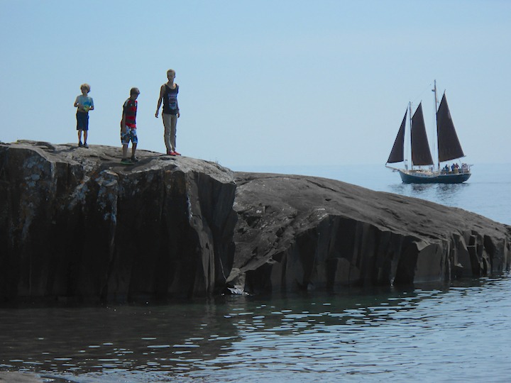
While drops aren’t far, it’s all rock or concrete, so watch over your youngest children at the edges of cliffs and the breakwall. Older kids will have a ball running, climbing and exploring.
11. Sweethearts Bluff
The Grand Marais Campground is on the west end of town. To access the trailhead for Sweethearts Bluff you’ll drive into the Campground and head to the far western side. This easy mile-ish hike goes uphill far enough to give nice views of the lake and Grand Marais harbor.
Family Hikes Northeast of Grand Marais along Hwy 61
So far most of the hikes we’ve covered get LOTS of visitors during the summer months. The ones past Grand Marais on the way to Canada can still get busy, but usually aren’t nearly as busy as the first ones on this list.
We think the best way to enjoy Okontoe and our area is to spend an entire week. That gives you plenty of time to have fun at your cabin or campsite AND get out for some of these fantastic hikes.
When you do, we highly recommend taking a day to explore the North Shore between Grand Marais and the Canadian border. Here are a few hikes on that stretch that are wonderful for families:
12. Kadunce River State Wayside: Kadunce River
(12 minutes from Grand Marais • 40 minutes from Okontoe)
You’ll find the small parking lot for the Kadunce River Wayside just off Highway 61, on the lake side of the road. It’s right next to the mouth of the river so there’s a bridge there where the road crosses it.
The trailhead is just across the road on the east side of the river. It’s an up-and-back hike of about 2 miles that takes you next to the river, eventually along the top of the high gorge rock cliffs and to a footbridge. That’s a good spot to turn around and head back.
While you’re at the Wayside you can enjoy the pebble beach at Lake Superior. There are no facilities.
13. Judge CR Magney State Park: Devil’s Kettle Trail
(17 minutes from Grand Marais • 45 minutes from Okontoe)
Magney State Park is famous for the Devil’s Kettle Trail, a section of the Brule River where the river splits and part of it disappears into a cauldron. It took until 2017 before the Minnesota DNR discovered where that water resurfaces!
The trail is short—just 2 miles there and back—but it’s vigorous. You’ll go down a couple hundred steps at the steepest section…and have to climb them back up again on the return trip! It’s worth it though.
There’s another set of smaller falls downriver from Devil’s Kettle on a short spur trail that’s also worth the extra few minutes.
You’ll need a state park vehicle permit to enter and park. Vault toilets are available.
14. Mount Josephine Trail
(41 minutes from Grand Marais • 71 minutes from Okontoe)
The views from Mount Josephine are some of the best in Minnesota. From 800 feet above Lake Superior you’ll be able to see the Susie Islands by Grand Portage and—on a clear day—Isle Royale in the distance.
It’s a short hike—just a couple of miles up and back—but strenuous. The first section is flat, but then much of it is a switchback trail that climbs and climbs.
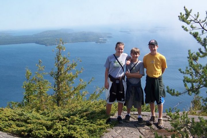
There are stunning overlooks of Superior before you reach the summit along with wonderful view of the Canadian shore. The summit itself looks over Grand Portage and the inland hills.
Parking is free but there are no facilities.
We have a separate blog post about the Mount Josephine hike if you’d like more details.
15. Grand Portage State Park: High Falls on the Pigeon River Trail
(44 minutes from Grand Marais • 74 minutes from Okontoe)
You’ll absolutely want to save time for the High Falls Trail while you’re at the Canadian border. This one is super easy and short—in fact, the trail is paved. It’s a mile in total.
High Falls is on the Pigeon River that divides Minnesota from Ontario, Canada. The river plunges over a rocky cliff 130 feet into the pool below and eventually out to Lake Superior. It’s the highest falls in Minnesota—twice as high as the High Falls at Tettagouche we listed earlier.
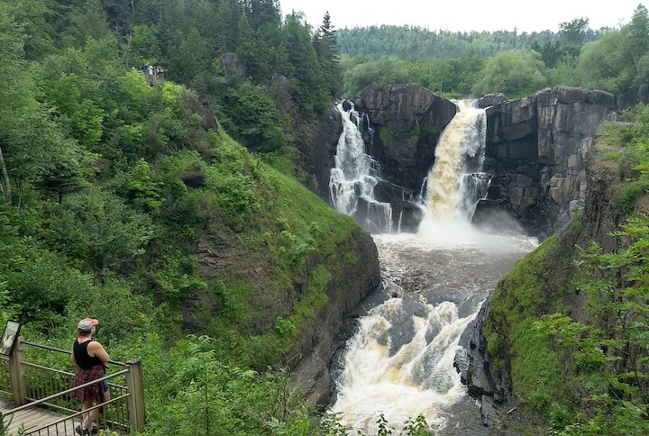
There are several short spur trails along the way that take you down to the river below the falls. The river is shallow in many places there and fun for kids (and adults) to explore.
If your family has your passports, the Canadian side provides more superb views. The border crossing station is just a stone’s throw from the parking area.
You won’t need a vehicle permit to park and the Visitor Center is worth a stop as well. Modern restrooms are available.
Then stop at Ryden’s on your way back for some ice cream and to browse their cool gift shop. They stock lots of Canada-themed items.
Gunflint Trail Hiking for the Whole Family
We have another blog post that covers most of these Gunflint Trail hikes in more detail, so we’ll keep it short here. These are all great options during your Okontoe stay.
16. Pincushion Mountain Trail
(7 minutes from Grand Marais • 33 minutes from Okontoe)
Pincushion is a 5-mile loop, although you don’t have to hike the entire way if you don’t want to. You can hike out to the overlook and back to cut off a good section of it.
If that’s your choice, it’s an easy hike. The most difficult part is a short (near-vertical) scramble up a granite face to the very broad and cool overlook. You’re rewarded with amazing views of Lake Superior from several hundred feet up as well as great views of the inland hills.
If you hike the whole loop you’ll have other overlooks of the Devil Track River canyon and get more varied terrain.
There’s a large parking area off the Gunflint Trail (County Road 12) about two miles up the hill from Grand Marais. A vault toilet is available.
17. Northern Lights Lake Overlook
(19 minutes from Grand Marias • 19 minutes from Okontoe)
Also known as the Blueberry Hill Trail, Northern Lights Overlook is a short, steep climb up the hill for nice views of Northern Lights Lake. It’s just a half mile up and back.
From the same small parking area is another trail that heads to where the Brule River flows into Northern Lights Lake. That’s an easy one that’s also a half mile there and back.
You’ll see a sign for the trailhead at a bend in the road. Go up the little hill right into the dirt parking lot. No facilities are available.
18. Moose Viewing Trail
(29 minutes from Grand Marais • 9 minutes from Okontoe)
We’ve never seen a moose here but you never know! It’s worth a shot and it’s a pretty little trail.
You’ll see a yellow sign that says “Moose Viewing Trail” off the Gunflint. A short drive takes you into a gravel parking lot.
One of the fun highlights of this trail for everyone is an old rusted-out car hidden in the woods. The trail ends at a couple of manmade platforms that overlook a pond and marshy area. For your best chance of seeing a moose, take it early in the morning or around dusk.
(These are also your best chances of being with all the mosquitoes, so bring bug spray!)
This trail is short and easy—maybe a half mile total. No facilities are available.
19. Honeymoon Bluff
(40 minutes from Grand Marais • 9 minutes from Okontoe)
If you only do one hike on the Gunflint Trail you’ll want it to be this one!
Take the Clearwater Road off the Gunflint Trail and drive down about 2 miles where you’ll see the trailhead sign pointing into the little parking area.
This loop hike is 1.5 miles total with spectacular views of Hungry Jack Lake from about 200 feet up. The overlook faces west, so the busiest time here is always around sunset. It’s very beautiful any time of day, though, and any time of year.
After a couple of steep sets of stairs, it’s pretty easy. Take your time on the stairs and you’ll be fine. There are dangerous drop-offs in several places at the top, so keep your youngsters close at hand.
No facilities are available.
20. Caribou Rock Trail
(41 minutes from Grand Marais • 10 minutes from Okontoe)
If Honeymoon is the sunset hike, Caribou is the sunrise hike—which isn’t quite so early the later into the season we go!
The Caribou Rock Trail is quite easy and very short if you just hike as far as the overlook above Bearskin Lake. The overlook faces east, which is why early mornings are gorgeous. There and back is a little over a mile.
To find the trailhead, take the Hungry Jack Road off the Gunflint Trail (it’s just southeast of Trail Center Lodge). Drive down a couple of miles (keeping to the left) and you’ll see a sign with pull-offs for parking. No facilities are available.
21. Centennial Trail
(59 minutes from Grand Marais • 28 minutes from Okontoe)
The trailhead for the 3+ mile Centennial Trail loop is the same as for the 37-mile Kekekabic Trail. So watch carefully or bring a map so you don’t end up deep into the Boundary Waters!
They start together, then Centennial splits off and follows an old railroad bed through the woods, overlooking a couple of inland lakes and back to the Gunflint.
There are no facilities available.
22. Magnetic Rock Trail
(59 minutes from Grand Marais • 28 minutes from Okontoe)
The trees in this area were first hit hard by the 1999 Blowdown then the 2007 Ham Lake Fire. New growth has sprung up since so if you haven’t been on it in a while, you may not recognize some of it anymore.
Named for Magnetic Rock (that really is magnetic), there are some beautiful views along the way of the surrounding hills and forest.
Once you reach the Rock, turn around and head back the way you came. It’s about 3 miles altogether and is a must-do hike at some point.
The trailhead is only a mile or past the Centennial trailhead. No facilities are available.
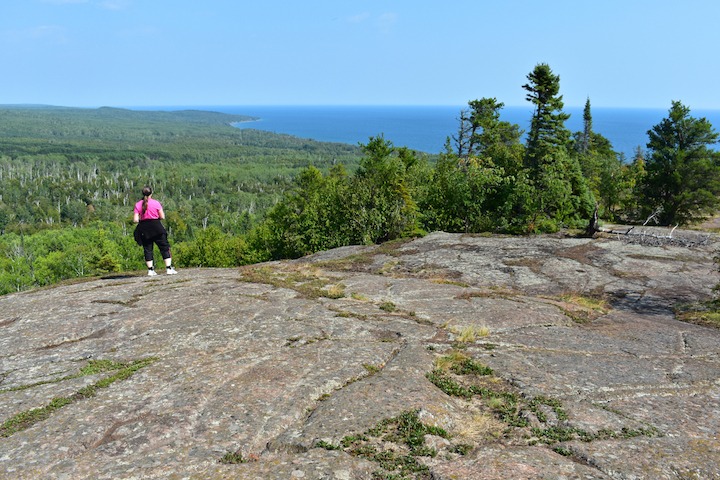
23. Chikwauk Museum Hikes • Blueberry Hill
(69 minutes from Grand Marais • 40 minutes from Okontoe)
Even though the Museum is more than an hour from Grand Marais we want to include it because it’s such a great family spot. The Chikwauk campus is a former fishing camp with some original buildings. It’s beautifully situated at the south end of one of Saganaga Lake’s long arms (Sag is one of the largest lakes up here).
The Museum itself is well worth going through with your family, as well as the other historic buildings. And there’s a network of very short hikes right in the area that are just a few hundred yards long.
The best hike, though, is to Blueberry Hill. It’s just 2 miles up and back from the main parking lot.
Some of it’s easy and some is moderately steep, but wow, the views you’ll get near and at the summit! 360º of Superior National Forest, the Boundary Waters and Saganaga Lake with the surrounding hills and forest.
This area was also hit hard by the Ham Lake Fire and Blowdown, and there are plenty of signs of both along the trail.
If you hike during July or early August you can expect to find blueberries on the LOADS of bushes that grow there (hence the name).
BONUS HIKE: Eagle Mountain
(37 minutes from Grand Marais • 52 minutes from Okontoe)
If you have older kids and if you’re all in decent shape, consider hiking up to Minnesota’s highest point while you’re in our area!
The Eagle Mountain trailhead is accessed off the Gunflint Trail via Devil Track Road. Your phone’s GPS should have no problem taking you there as long as you pull the map up while you have cell service. It’s pretty clearly marked along the drive too.
This hike isn’t that difficult other than the length. It’s an out-and-back trail that’s about 7 miles total. Most of it is easy other than plenty of rocks and tree roots embedded in the trail, and possible mud. It’s just the last third or so that has steep sections.
The best views aren’t from the summit, which is surrounded by trees. So follow the trail to the summit, get your photo with the plaque, then retrace your steps to enjoy the wonderful overlooks at your leisure. Packing a lunch or hearty snack is a great idea for this one.
Eagle Mountain is in the Boundary Waters, so you’ll need to fill out a (free) day pass at the kiosk at the trailhead. Put a copy in the box there and bring a copy with you. The parking area is quite large and there’s a vault toilet if you need it.
Some of the Boundary Water’s rules apply to hiking this trail:
- No more than 9 people in your party
- No glass or metal food containers
- Of course, pack out all your trash
Summary
Conquering this list ought to take your family many trips to Okontoe!
That’s one of the best things about our location—easy access to all the North Shore, Grand Marais and the Gunflint Trail have to offer.
Click below to see availability for our Retreat Cabins or campsites:
Book Your Stay at Okontoe Today
Article and photos by Sharon Brodin
1 thought on “23 of the Best Hikes for Families Near Grand Marais”
Comments are closed.