Mount Josephine is just five miles from the Minnesota/Canada international border. The hike to its summit is one of the most beautiful in the state.
Don’t miss it if you’ll be in the Grand Marais/Grand Portage area!
Why You’ll Love the Mount Josephine Hike
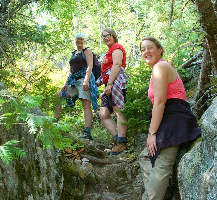
It’s Challenging
If you start at the trailhead (more on that below) you’ll have an easy first mile through the woods. Once you hit the uphill, it’s almost all uphill the rest of the way.
It’s about a 700-foot elevation gain in the second mile, with some very steep stretches. You’ll want good knees for this one!
Near the top, the trail branches off in different directions, with spur trails leading off a couple places. Pay attention so you know where the main trail is, especially heading back down.
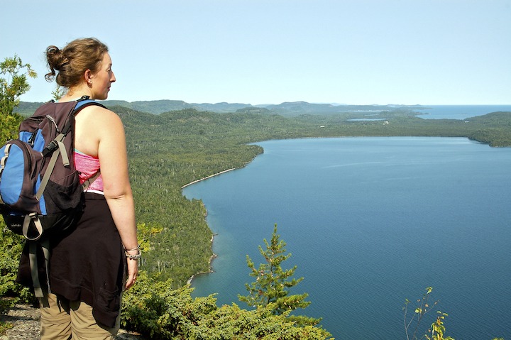
It’s Gorgeous
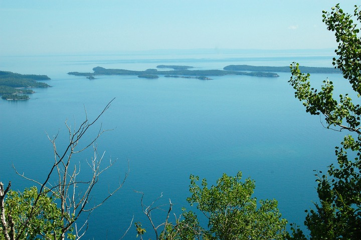
As you hike up through the forest, there are several places you’ll be able to overlook Lake Superior and the nearby Susie Islands. Then before the summit you’ll start to see some of those spur trails heading off to the right. Take them for the best and highest overlooks.
Bring a backpack with water and snacks and plan to stop for awhile on one of the rock outcroppings that give these unobstructed views. You’ll be able to see the rugged Canadian shoreline, Lake Superior in its glory and the closer islands.
On a clear day you should be able to see 45-mile-long Isle Royale on the horizon looking across the lake.
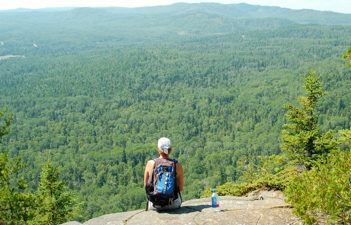
The views from the summit itself aren’t quite as stunning. But walk down from the summit a little on the west side, or behind it to the north, and there are very nice overlooks of the inland ridges and forest.
Blueberries!
If you hike this trail in early-mid July through early-to-mid August, bring containers for blueberry picking. There are hundreds of bushes on the summit. Or just pick a few handfuls to enjoy during your hike.
Enjoy (some of) the Views without the Hike
Drive northeast on Highway 61 past the casino and National Monument area. You’ll see a rest area on the lake side of the road. Stop there, and the views are almost as good as from Mount Josephine. (Josephine will be on your right as you’re looking out to the lake.)
You won’t be as high, but you’ll get the idea. Same lovely Canadian shoreline…same beautiful Lake Superior.
How to Get There
Finding the trailhead for the Mount Jo hike can be a trick. Take a look at the map below:
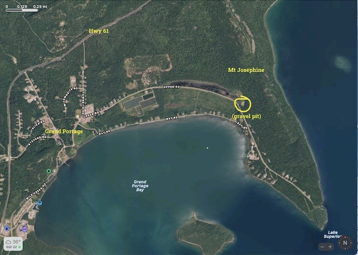
You can turn off 61 at the gas station (Mile Creek Rd). Follow that road along the lake past the National Monument. At the Y, stay to the right, which is Upper Road. You’ll stay on that until you get to the trailhead, which will be on your left.
Some years there’s been a sign designating the little trailhead parking lot, and some years we haven’t been able to find it. If you miss it, keep going around the bend and you’ll see an old (unmarked) gravel pit on your left.
We and others have parked in there plenty of times. Follow the ATV trail across the meadow. You’ll approach the beginning of the uphill portion of the trail from the east, then, instead of the west.
What Else to Do While You’re in the Area
The last five miles on Highway 61 between Mount Josephine and the border are five of the most gorgeous miles anywhere. Mountains (Midwestern-style, of course), forest and lakes (including the Big Lake). Even if you don’t stop anywhere, the drive is worth it.
If you want to stop, there’s plenty to do:
Grand Portage National Monument
Grand Portage National Monument is worth at least half a day. There was a thriving fur trading post on that site in its heyday. Today it’s part of Grand Portage Indian Reservation with a rebuilt Fort, Ojibwe Village, Canoe Warehouse and Heritage Center.
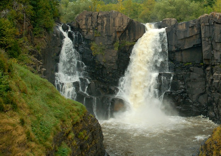
Grand Portage State Park and High Falls
Grand Portage State Park is up Highway 61 just before the Canadian border (you can see the border crossing as you drive into the Park)—it’s literally at the tip of Minnesota’s Arrowhead.
The highlight here is the easy, paved half-mile hike to 130-foot High Falls on the Pigeon River. These falls and the surrounding basalt rock is impressive! There are longer hikes, too, if you still feel ambitious.
Ryden’s Border Store
As long as you’re here, stop into Ryden’s Border Store for souvenirs from both the US and Canada. This family-owned business offers a ton of fun items.
The Grand Portage (the trail)
The Grand Portage is an actual portage—and a very historical one. First the Native Americans and then the French Voyageurs used it back in the day to bypass the series of waterfalls on the Pigeon River heading from Lake Superior inland to the lakes of the fur trading routes. It’s 8.5 miles long!
If you look close along Highway 61, you’ll see a sign that designates this very unassuming trail heading inland. Picture hiking that with a canoe on your back, or a 50-60 pound pack.
The Grand Portage area is well worth a day trip when you stay at Okontoe, if you’re going to be with us for several days to a week (one of the reasons we suggest an extended stay!).
You’ll drive back to Grand Marais (30 minutes), then head northeast on Highway 61 for about 45 miles.
Book Your Stay at Okontoe Today
(Article and photos by Sharon Brodin)
2 thoughts on “Hike Mount Josephine for Amazing Views of Lake Superior”
Comments are closed.