During your visit to Okontoe, be sure to take advantage of the many great hikes along the Gunflint Trail.
Minnesota’s Gunflint Trail is sandwiched on either side by one of America’s most unspoiled wilderness areas, the Boundary Waters Canoe Area Wilderness.
Located in the northeast corner of our state, this 56-mile road begins in Grand Marais. It winds its way northwest to end at the crossroads of Seagull and Saganaga Lakes, near the Canadian border.
Okontoe is in the middle of “the Trail.”
Well-known for its many entry points into the Boundary Waters, the Gunflint Trail is also home to private homes, several outfitters, lodges and campgrounds, and many beautiful hiking trails.
Eight of them are short enough to be well-suited for your whole family and offer gorgeous views. We’ll start closest to Grand Marais and work our way out from there:
1. Pincushion Mountain Trail
Pincushion Mountain, being so close to Grand Marais, is very popular—in the summer for hikers and in the winter for cross country skiers.
You can do the entire 5-mile loop, or hike it as an out-and-back trail from the parking area to the overlook and back.
The views from the broad summit of Pincushion Mountain itself are gorgeous! Especially on a day when Lake Superior is super blue. You can see far along the shore to the northeast as well as back to Grand Marais to the southwest.
You have to take a major scramble up a granite face of maybe 25 feet to reach it. As long as it’s not wet or icy, you’ll be fine!
The trailhead starts about 3 miles up the Gunflint from Grand Marais. Look for the brown Pincushion Mountain sign on your right coming from town.
If you’re coming from Okontoe, you’ll see the sign on your left just as you begin to head down the last big hill into town.
2. Northern Lights Lake Trail
The trailhead for this hike is about 13 miles from Grand Marais, well-marked, with a small parking area on the right side of the road, if you’re coming from town.
If you’re coming from Okontoe, the trailhead is just before a large curve and just past the boat launch for Northern Lights Lake.
The trail ascends Blueberry Hill, which will be obvious if you hike from mid-July to mid-August.
The ascension is quite steep, but well worth the effort with great views of Northern Lights Lake and the surrounding ridges. It’s a half mile out-and-back unless you also take the hike to Northern Lights Lake, then add another half mile.
[2025 Update: We’ve heard the views from the top are starting to lessen as the trees grow taller! Let us know what you think when you hike it.]
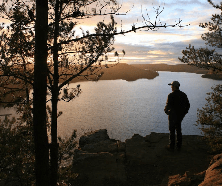
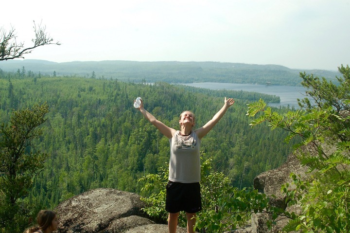
3. Honeymoon Bluff Trail
Honeymoon Bluff is one of the Gunflint’s premier and most popular trails, and it’s the one on our list closest to Okontoe.
To get to the trailhead take a left out of Okontoe’s road onto the Gunflint, then a quick right on Clearwater Road. Drive the dirt road about two miles to the trailhead parking area on the left, directly across from Flour Lake.
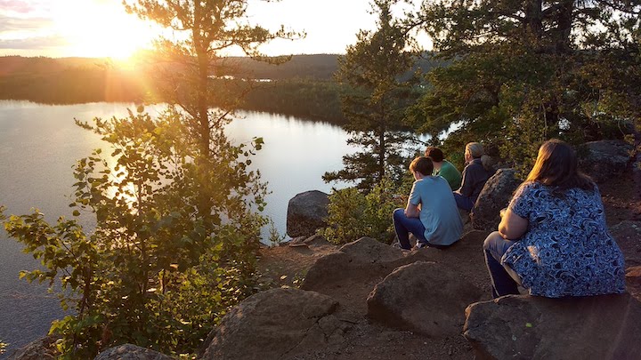
Honeymoon is most popular for sunset hikes—you’ll see why when you get there! The high bluff overlooks Hungry Jack Lake looking west, the perfect setting for lovely sunset photos.
Bring a flashlight if you plan to stay until the last rays disappear so you can find your way back down. (The header image on top is the Honeymoon Bluff overlook, too.)
Keep your young children and dogs close-at-hand once you get to the overlook. The steep cliffs are fenced off, but not kid or dog proof!
It’s 1.5 miles total, with a steep uphill the first half, including a few dozen steps.
4. Caribou Rock Trail
The Caribou Rock trailhead is just another mile or two up the Gunflint Trail. Take a right on the Hungry Jack Road just before you get to Trail Center.
Drive down a couple miles, keeping to the left, to the trailhead. You’ll see small parking areas on either side of the road.
This short, moderately-uphill trail leads you to an overlook above West Bearskin Lake. Since it faces northeast, this is your sunrise photo op if you’re a morning person!
For more adventure, continue on this trail for another 3+ miles (it becomes the Split Pine Trail) and you’ll reach the Stairway Portage/Rose Falls area. This is one of the most popular canoe day trips in the Boundary Waters.
The trail to Stairway is challenging with a lot of hills, so bring water and extra snacks and be prepared for a workout!
You can also take the Moss Lake trail from Caribou Rock, which takes you to Moss Lake and back to Hungry Jack Road.
If you stick to the Caribou Rock Overlook and back, it’s 1.5 miles.
5. Gunflint High Cliffs Trail
Continue up the Gunflint Trail and, about 20 miles from Okontoe, take a right on the road to Gunflint Lodge. Stop in the Lodge and ask for a map for the High Cliffs Trail. The staff there is very friendly and helpful.
The trailhead begins behind the Lodge property and climbs up to a cliff high above Gunflint Lake, looking over to the Canadian shore (Ontario). Simply stunning! And another place to keep your young children and dogs close by.
I can’t find a trail length anywhere, including from Gunflint Lodge’s website, but it’s in the neighborhood of a couple miles round trip.
(Gunflint Lodge has great food if you need nourishment after your hike!)
6. Centennial Trail
Three miles past the Gunflint Lodge road is the trailhead for the Centennial Trail, on the left.
(This trail follows the beginning of the 37-mile Kekekabic Trail, too—so be sure and pick up a trail map there and watch for your turn-off, so you don’t end up deep into the Boundary Waters!)
If you take this trail in mid-July to mid-August you’re likely to find wild blueberries, raspberries and Juneberries.
The Centennial Trail follows an old railroad line in a loop through forest, onto a high ridge with great views, and down again.
TIP: Keep an eye out right after you pass signpost #8—the trail takes a sharp right turn and heads uphill. Many hikers miss it and keep going straight, so it looks like that’s the trail, too. You’ll soon find it gets more and more untrail-like!
This trail is moderately difficult with one very steep section heading down. That part could be very sketchy in the rain, FYI.
[2025 Update: The trees along this trail have grown up a lot in the past ten years, blocking many of the views that were once in the open. It’s still worth doing, though!]
7. Magnetic Rock Trail
Just a mile past the Centennial trailhead and on the right is the trailhead for the Magnetic Rock Trail.
This area was affected by the Blowdown of 1999, where millions of trees were leveled by straight-line winds, then a controlled burn and then the 2007 Ham Lake fire.
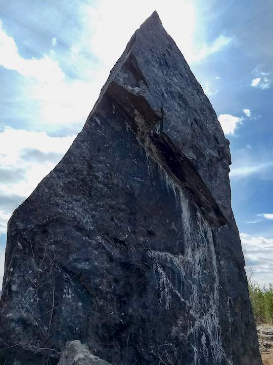
As a result, much of this trail was out in the open with tons of wildflowers, berries and views. The small trees are growing up again now, and someday this trail will be in mature forest again.
There are beautiful overlooks along the way, then suddenly you’re faced with 60-foot high Magnetic Rock. 3 miles out-and-back.
[2025 Update: The trees have indeed grown up again, including around Magnetic Rock itself. The scenic overlooks are still wide open, though, and the whole thing is beautiful.]
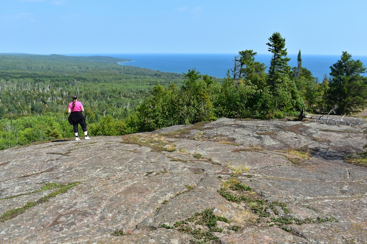
8. Blueberry Hill Trail
55 miles from Grand Marais—nearly to the end of the Trail—is the Chik Wauk Museum, and several lovely hikes. The Blueberry Hill Trail is known for its stunning views of the area including Seagull Lake, Saganaga Lake, the Boundary Waters and Canada.
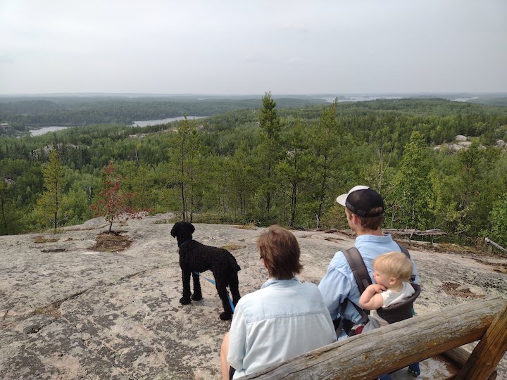
And, again, get there at the right time of the summer and you’ll be rewarded with the Trail’s namesake berries. 2 miles total with some moderate-to-steep uphills at times.
(You know you’re at the summit when you see the bench in the photo above!)
While there, the Chik Wauk Museum is a definite must-see for a peek into the cultural history of the Gunflint Trail. It’s very well done, and is housed in a couple historic stone and log buildings once used as a fishing lodge. Only $5 for adults and $2 for children over four (2021 prices).
Bring bug spray during the summer months, water and light snacks, sturdy hiking shoes and you’re set to go. It never hurts to bring rain gear and layers as our weather up here is very changeable.
Enjoy!
Book Your Stay at Okontoe Today
(Article and photos by Sharon Brodin.)
5 thoughts on “8 Short and Scenic Hikes along the Gunflint Trail”
Comments are closed.